05.07.2023, 1730hr IST: Rainfall realized
a) Rainfall reports for last 3 hours(in mm) – Panaji:10.0, Mapusa:17.0, Margaon:8.5 mm
b) Cumulative since rain event started around 08:30IST of today (in mm) – Panaji:77.0, Mapusa:76.0, Margaon:74.5 mm
As per latest observations,
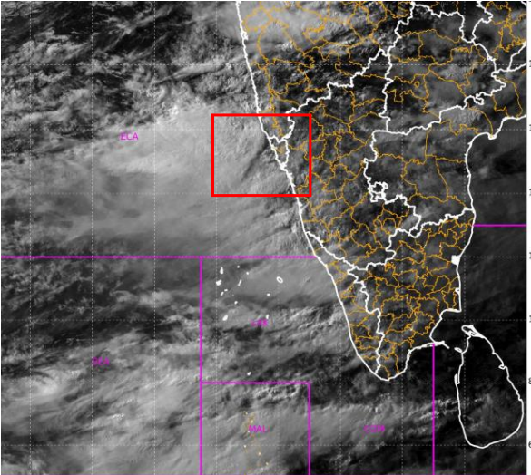
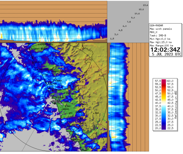
- Moderate spells of rainfall activity is going on over talukas of North Goa districts
- Rain bearing clouds are approaching from Arabian Sea North Goa & South Goa districts. Panaji and most places over North Goa & South Goa districts are most likely to experience Moderate to heavy rainfall spells during next 4 hours.
- Intense spells are very likely at times for short intervals.
- Rain is most likely to be accompanied with winds of speed around 40 to 50 km/hr over North Goa and South Goa districts.
- Isolated locations and ghats may receive prolonged spells of rains.
Impact expected Over North Goa and South Goa districts during next 12 hours
- Short term water logging/flooding of roads and low lying areas
- Water entering homes in low lying areas
- Fall of weak trees and weak structures
- Localized and short-term disruption to municipal services (water, electricity, etc.)
- Inundation/ flooding in urban or city areas.
- Congestions on roads/rail traffic
- Damage to standing crops and vegetables
- Rough sea conditions along the coast
- River/ canal water levels rising temporarily to danger levels
- Water flowing over roads and small bridges
- Localized mudslides and landslides at vulnerable areas.
- Possibility of water stagnation in mining pits
- Temporary fall in visibility during intense spells of rain.
- Damage to mud houses